Lake City Ice Climbers, Inc. Link
![]()
Lake City Ice Park: The Mountain Project
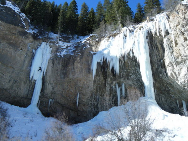
Admission to the Ouray Ice Park is free, climbers are encouraged to join the Ice Park to provide support for this excellent facility.
Hours: Monday- Friday: 8 am- 4 pm
Saturday- Sunday: 7:30 am- 4 pm.
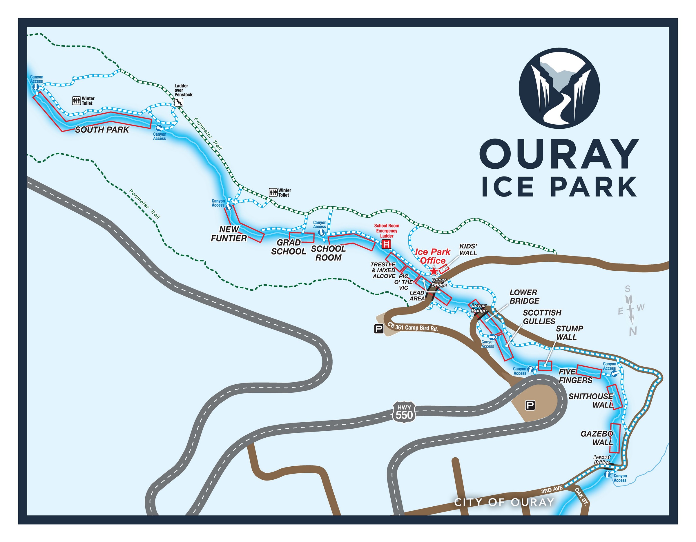
Ouray Ice Park Maps:
Ouray Ice Park Maps:
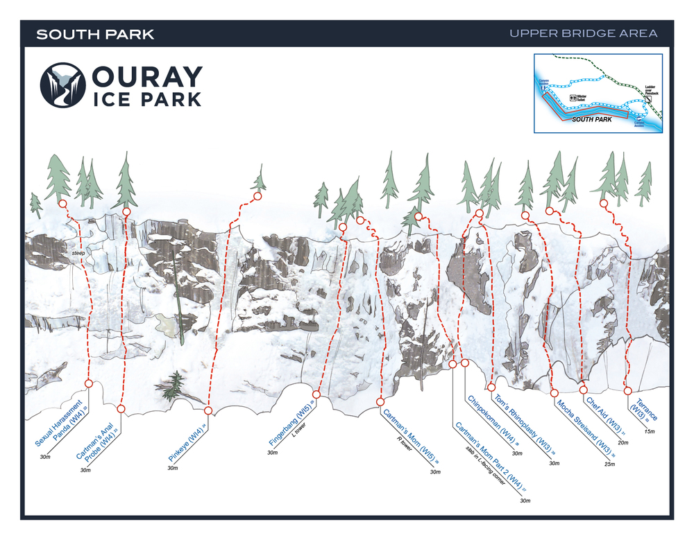
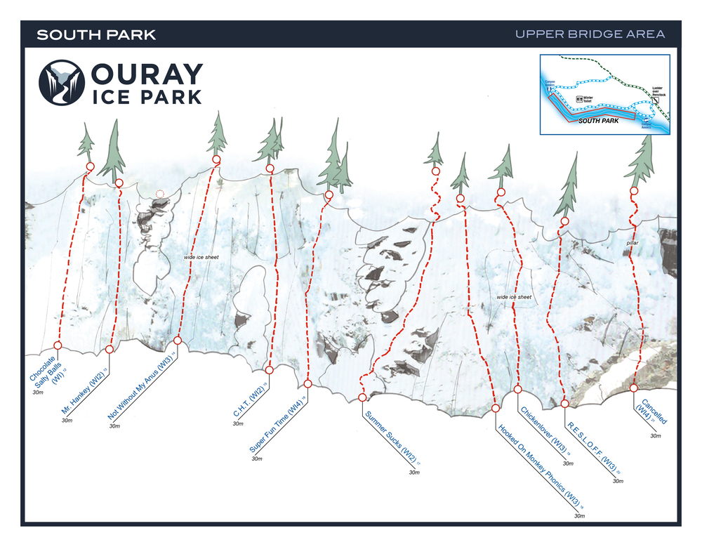
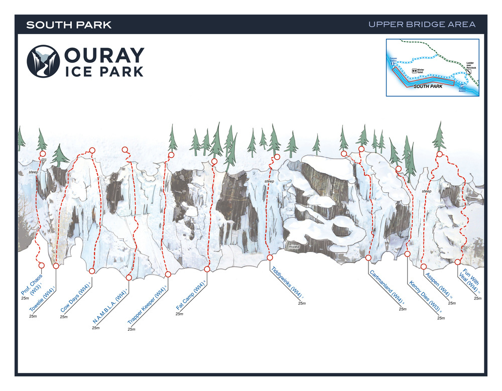
South Park: Upper Bridge Area: WI2- WI5, 32 Routes
Grade Range: WI2- WI5
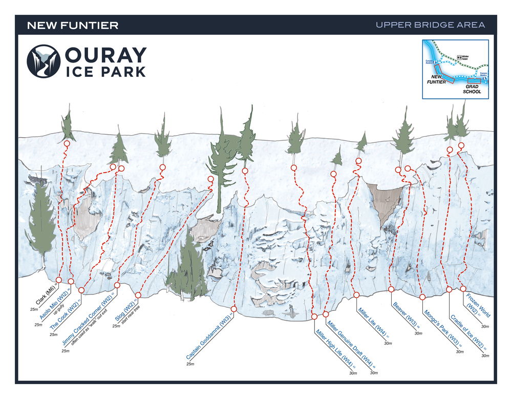
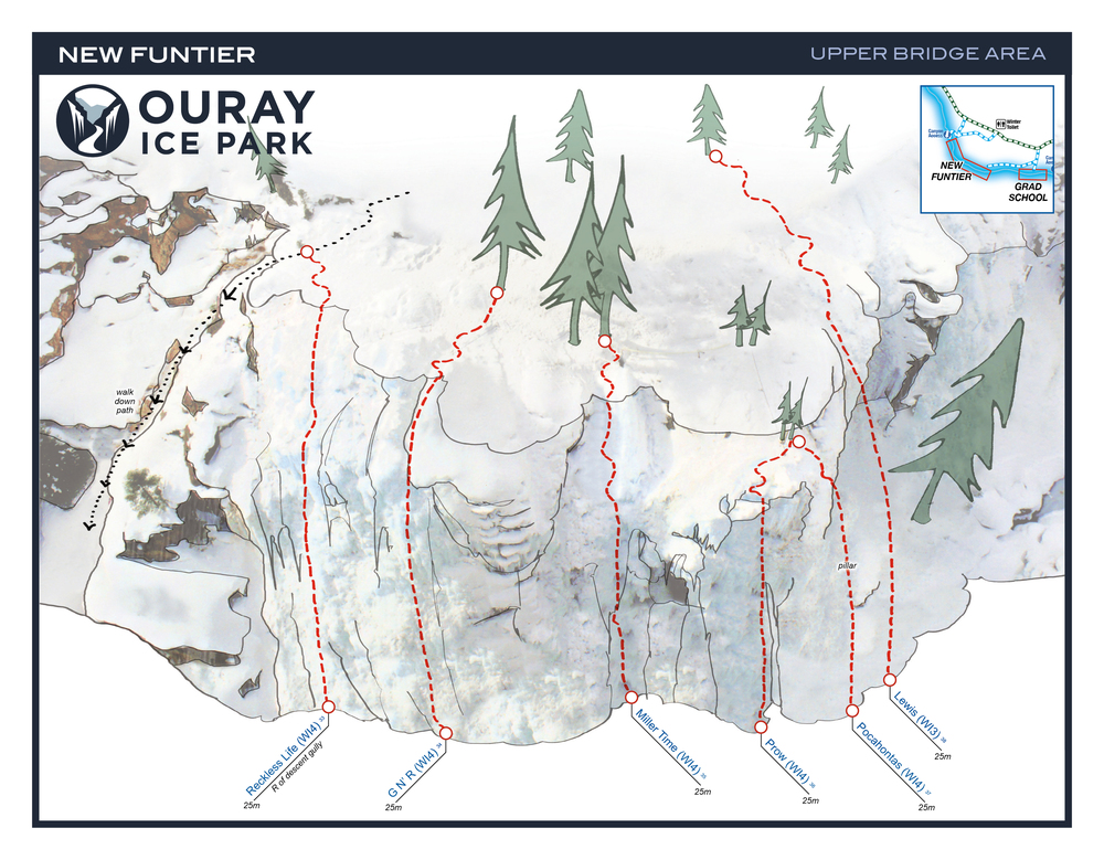
New Funtier: WI2 – WI4, 13 Routes
Grade Range: WI2 – WI4
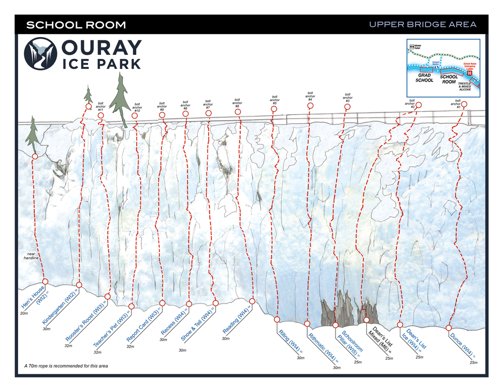
Schoolroom: WI2- WI5, 17 Routes
Grade Range: WI2-WI5 & M4- M6
Trestle + Mixed Alcove: WI3/4- M9, 23 Routes
Grade Range: WI3/4 to M9 Mixed
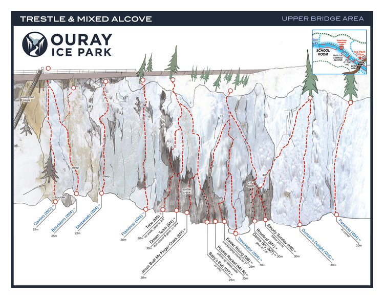
Climbs: “Jesus Built My Finger Crack” (M4, gear)
“Easter Rising” (M8+, gear)
Lead Area – Upper Bridge: WI4/5 to M-hard, 15 Routes
Grade Range: WI4/5 to M-hard “Lead area only, no top roping”
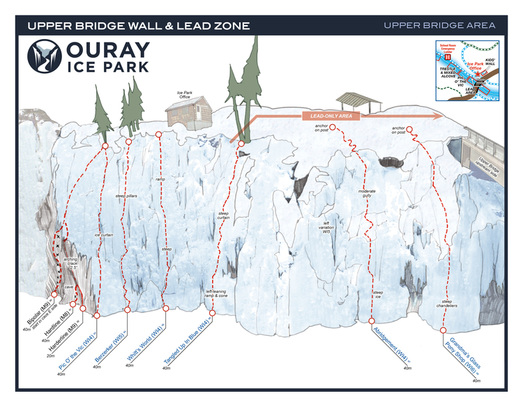
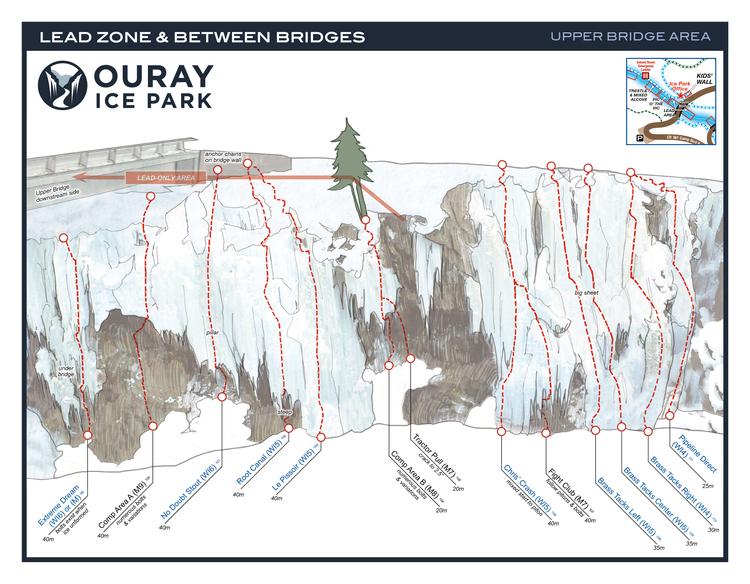
Mixed Routes: Comp Routes Hardline (M9, gear) Fight Ckyb (M7, bolts)
Lower Bridge: WI3 to M9, 31 Routes
Grade Range: WI3 to M9 Mixed
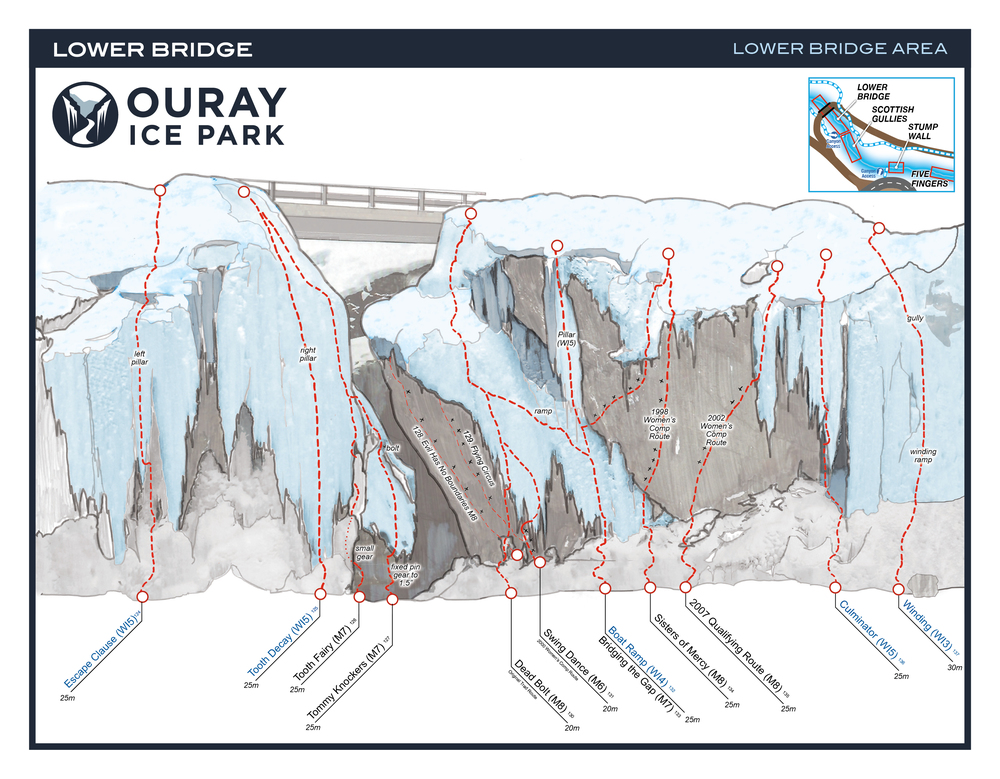
Routes:
Sisters of Mercy (M7, bolts)
Super Dave: (M7), gear
Tic Tac (M7, bolts)
Scottish Gullies, WI2/3- WI4, 6 Routes
Grade Range: WI2/3 – WI4
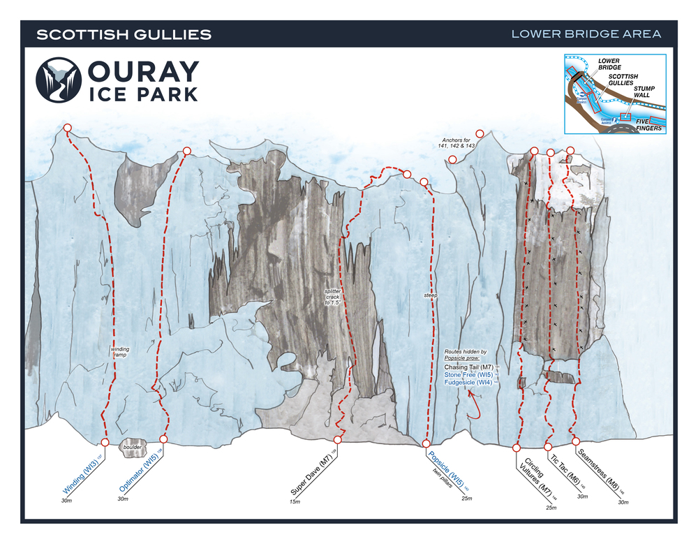
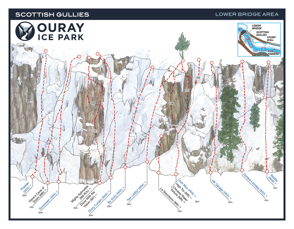
Mixed Routes:
Mighty Aphrodite (M9 R/X, Small Cams and Stoppers)
Dizzy with a Vision (M7, Botls and Ice Screws)
Water Torture (M8, Bolts)
Supremacy Crack (M7/M8, Gear)
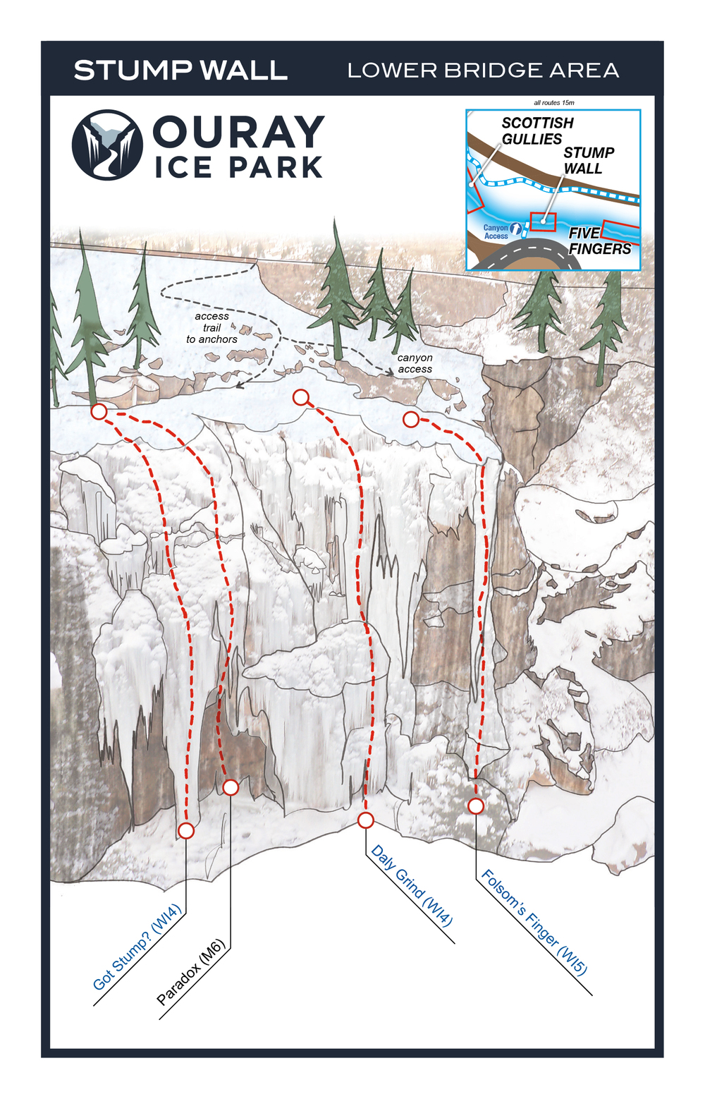
Stump Wall: WI4 – WI5 to M6, 4 Routes
Grade Range: WI4 – WI5 to M6
Five Fingers: WI4 to M7, 10 Routes” open=”false”] Grade Range: WI4 to M7
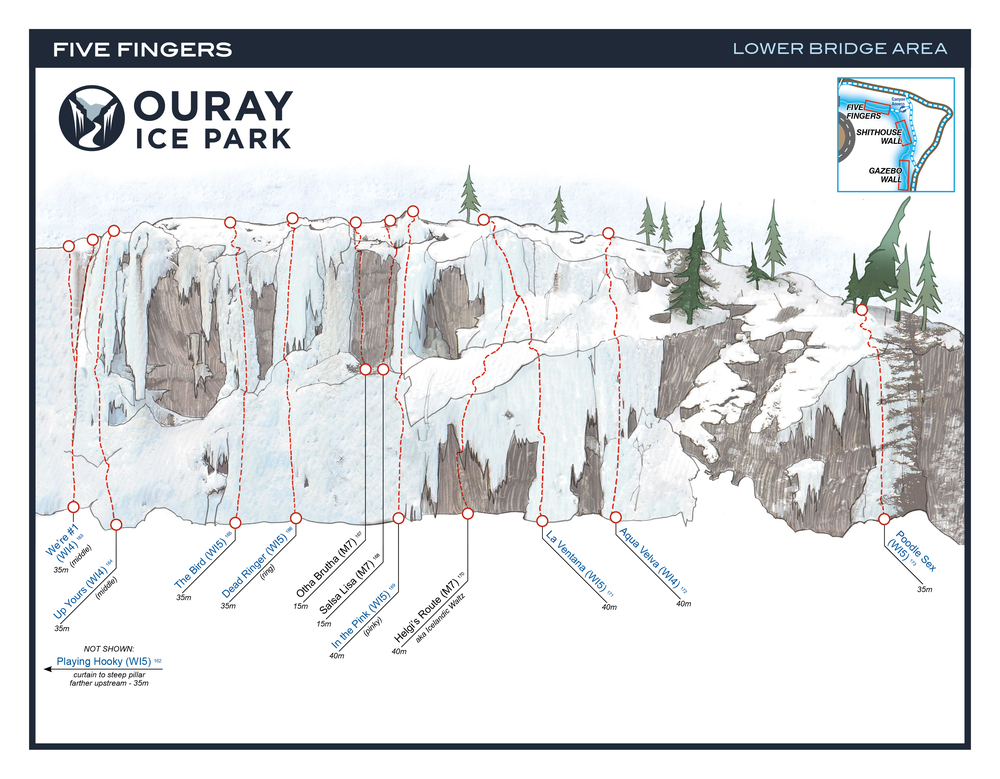
Mixed Climbs: Uddah Bruddah (M7, bolts) Salsa Lisa (M7-, bolts) Helgi’s Route (M7, bolts and gear)
Shithouse Wall: W13 – W15, 5 Routes
Grade Range: W13 – W15

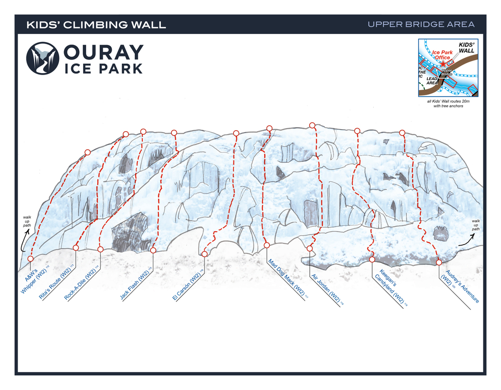
Kids Climbing Park: Grade Range: WI2, 9 Routes
Cette zone est juste à l’ouest du pont supérieur et pas dans la Gorge de Uncompahgre, avec des itinéraires de niveau débutant à intermédiaire, avec une Grange de WI2 de Grade.
January 18- 21, 2018
The Mountain Project Link
]]>
Ice Climbing: the Park offers excellent ice climbing form late December until into March. Routes range from WI4+- 6
Directions: north of Rifle on Highway 13, then east of Highway 325; continue past Rifle Gap and Rifle Falls State Parks, travel past the fish hatchery to the Park.
Fees: Daily Vehicle: $5 Annual Passes are offered from $15 to $50 depending on residence location. Camping: Including the Day Pass: $15 (camping fees are discounted with proof of annual pass.) The campground is currently dry, with water available at the Rifle Falls and Rifle Gap State Parks.
Rifle Mountain Park Routes:
[/cs_text][/cs_element_column][/cs_element_row][/cs_element_section][cs_element_section _id=”19″][cs_element_row _id=”20″][cs_element_column _id=”21″]
![]()

Many of the same trails used for snow shoeing and cross country skiing can be used for snow biking.
Snow Biking venus:
Crested Butte Nordic Center: the Crested Butte Nordic offers 13 kilometers of groomed trails that are open to fat biking and free to use. Trail Map
Roaring Fork Mountain Bike Association Trails
Grand Mesa Snow Biking: the Unite States Forest Service (USFS) prohibits snowbikes on the Skyway, County Line, and Ward Trail Systems. Snowbikes, also known as fat bikes, are typically allowed on snow packed roads and snowmobile trails. Trail Map
Town of Telluride Valley Floor Trail Map.
]]>Snowshoeing in Western Colorado offers endless options to explore the back country in winter. Many of Western Colorado’s nordic centers and ski areas cater to the snowshoers, many with groomed trails and equipment rental. Snowshoeing offers a cost effective way of being out and about in the winter time. Below are links to nordic centers in ski areas, with the interactive map offering even more options for showshoeing.
What to wear:
■ Base layer: wool socks, thermal underwear (tops and bottoms)
■ Middle layer: long-sleeved shirt or fleece jacket
■ Outer layer: Waterproof jacket, gloves, snowpants and hiking shoes or boots; hat, & snowshoes
■ Other items: Polarized sunglasses; water; ski or trekking poles; gaiters, daypack with extra socks, sunscreen, first-aid kit, camera, snacks
Where to Go:
■ Check out out map guide for some of the many locations here in Western Colorado.
■ National and State Parks provide areas for snowshoeing.
Nordic Centers that offer showshoeing and cross country ski trails:
■ Aspen/ Snowmass Nordic Trail System: 80 Kilometers of groomed trails; one of the largest free cross-country skiing and snowshoeing trail system in North America (Trail Map).
■ Crested Butte Nordic Center: more than 50 kilometers of trails (Trail Map).
■ Gunnison Nordic
■ Purgatory
■ Steamboat Springs: Haymaker Nordic Center, Steamboat Springs Ski Touring Center
■ Telluride TopAlten Nordic and Snowshoe Area.
■ Vail Nordic Center: 17 kilometers of cross country ski trails, and 10 kilometers of snowshoeing trails (Trail Map).
■ A sampling of Western Colorado Snowshoe Trails:
[wpgmza id=”2″]