Moab: Navajo Rocks Area

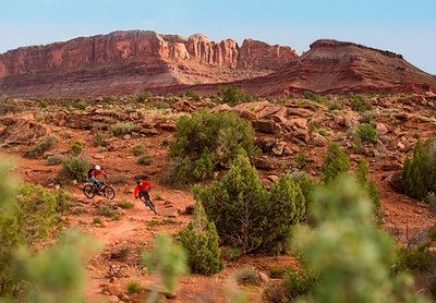
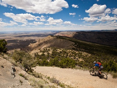
Moab: Navajo Rocks Area The Navajo Rocks Riding Area is about 10 miles north of Moab off of State Highway 313. The first part of the trail system was completed by May 2013. The first trail head is 5 miles from State Highway 191 north. Basecamp Moab Link 7-UP Hey Joe – Spring Canyon Loop Chisholm Trail Whirlwind Loop Hidalgo …

Moab: Dead Horse Point

Moab: Dead Horse Point Dead Horse Point sits about 2,000 feet above a gooseneck in the Colorado River. The Dead Horse Point State Park is nine miles northwest of Moab on US 191 and then 23 miles southwest on Utah 313 to the end of the highway. Opened to the public as a state park in 1959, with an elevation: …

Moab

Ride: Moab Moab is the county seat of Grand County, Utah. Eastern Utah is the home to world class slick rock mountain biking. Prior to community settlement in the 1850’s by Latter-day Saints coming from the north, Moab was the main crossing point of the Colorado River on the Old Spanish Trail for traders, trappers, and travelers between the Missions …

Loma: Kokopelli Trail Area

Ride: Loma, Kokopelli Trail Area Loma is an unincorporated area in Mesa County just west of Grand Junction. Take the Loma Exit from I-70, turn left (south) off the exit to the Kokopelli Trail parking area, just south of the interstate. [wunderground location=”Loma, CO” numdays=”4″ layout=”simple”] Basecamp Fruita Link Kokopelli Trail Kokopelli Loops – Marys, Horsethief, Steves, and Wranglers Marys …

Grand Mesa

Ride: Grand Mesa In West Central Colorado sits the Grand Mesa, the largest flat topped mountain in the world at an area of about 500 square miles.  Located just 35 miles north west of Montrose and 40 miles east of Grand Junction, the mesa sits about 10,000 feet in elevation.  With over 300 lakes and reservoirs makes the Grand Mesa …

Gunnison, Hartman Rocks

Ride: Hartman Rocks The Gunnison area has multiple options for single track, in two basic areas, the Hartman Rocks and the University regions. The Hartman Rocks group of trails provide 40 miles of singletrack trails and an additional 33 miles of open road for biking. Opportunities for recreation include biking, hiking and trail running. There are also a new adaptive …

Gunnison Gorge NCA

Ride: Gunnison Gorge NCA Access to the Gunnison Gorge National Conservation Area for Mountain Biking in the “Flat Top Peach Valley Recreation Area” is found north-east of Montrose. Turn east from Highway 50 north of Montrose, on Falcon Road for three miles to the end of the pavement and on to Peach Valley Road. At the Falcon Road intersection with …

Fruita- 18 Road Region

The Main Parking Lot is on 18 Road, north of Fruita. From Highway 50 Business in Fruita, drive north on Maple Street, continue north and Maple turns into 17 1/2 Road. Continue North on 17 1/2 Road for several miles and to the east (right) on N 3/10ths Road, turn again left in a half mile on 18 Road, following 18 …

Ride: Crested Butte

Crested Butte can claim to be the center of the mountain biking universe with the invention of what locals called the “Klunker” in the early 1970’s.  At that time, the only real paved street in Crested Butte was Elk Avenue, with side streets full of pot holes.  The “Klunker” bike was an older large bike with larger tires to enable …

Ride: Canyons of the Ancients

The Canyons of the Ancients National Monument is located west of Coretz in the southwest corner of Coilorado. This national monument was created in 2000, consisting of 176,056 acres and managed by the Bureau of Land Management. Within the boundaries of this monument are three of the four sections of Hovenweep National Monument (National Park Service). The Monument was created …