Mount Zirkel Wilderness Area

JMorganWilderness Areas

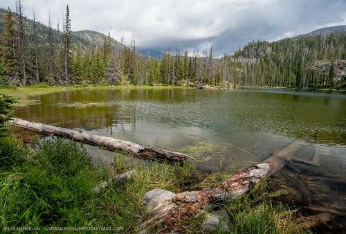
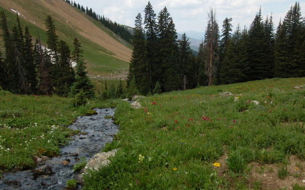
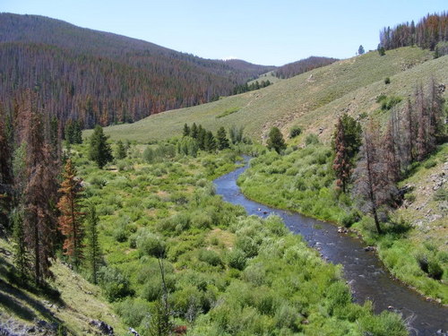
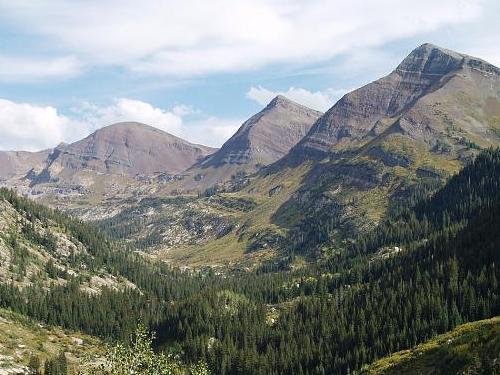
Located near Steamboat Springs in north central Colorado, the Mount Zirkel Wilderness area is managed by the Medicine Bow-Routt National Forest. The Area was one of the five original wilderness areas that were designated by the 1964 Wilderness Act.  A …

Never Summer Wilderness Area

JMorganWilderness Areas

Never Summer is part of the Arapaho and Medicine Bow-Routt National Forests.  This Wilderness Area is just west of Rocky Mountain National Park and straddles the Continental Divide.   USGS Topo maps link:   Bowen Mountain Grand Lake Mount Richthofen …

Platt River Wilderness Area

JMorganWilderness Areas

The Platt River Wilderness Area is located in south central Wyoming and north central Colorado.  The Wilderness Area is managed by the Medicine Bow-Routt National Forest. The Wyoming area is located in the original Medicine Bow National Forest, with the …

Raggeds Wilderness Area

JMorganWilderness Areas

Located in the GMUG (Grand Mesa, Uncompahgre, Gunnison) and White River National Forests northwest of Crested Butte. USGS Topo maps link: Chair Mountain Marble Paonia Reservoir Marcellina Mountain Oh-Be-Joyful Snowmass Mountain Established:  1980 Acres: 65,393 Elevation Range: 6,840- 13,536 Peaks: …

Sarvis Creek Wilderness Area

JMorganWilderness Areas

The Sarvis Creek Wilderness Area is located south of Steamboat Springs and administered by Medicine Bow-Routt National Forest. USGS Topo maps link: Green Ridge Gore Mountain Tyler Mountain Blacktail Mountain Walton Peak Lake Agnes Established: 1993 Acres: 45,190 Elevation Range: …

South San Juan Wilderness Area

JMorganWilderness Areas

Located east of Pagosa Springs, the South San Juan Wilderness Area is administered by the San Juan National Forest. USGS Topo maps link: Chromo Mountain Chama Peak Archuleta Creek Cumbres Harris Lake Elephant Head Rock Victoria Lake Spectacle Lake Blackhead …

Uncompahgre Wilderness Area

JMorganWilderness Areas

The Uncompahgre Wilderness Area, formerly called the Big Blue Wilderness, is managed by the Grand Mesa Uncompahgre Gunnison (GMUG) Forest. USGS Topo maps link: Dallas Courthouse Mountain Sheep Mountain Alpine Plateau Ouray Wetterhorn Peak Uncompahgre Peak Lake City Established: 1980, …

Weminuche Wilderness Area

JMorganWilderness Areas

The Weminuche Wilderness Area in southwest Colorado is managed by the Forest Service by the San Juan National Forest. USGS Topo maps link: Lemon Reservoir Vallecito Reservoir Granite Peak Bear Mountain Oakbrush Ridge Pagosa Peak Saddle Mountain Wolf Creek Pass …

West Elk Wilderness Area

JMorganWilderness Areas

Located in the West Elk Mountains, the West Elk Wilderness Area is located northwest of Gunnison, and north of Crawford. The Wilderness Area presents a different geology from the West Elk Mountains. Made up of West Elk Breccia, which has …

Holy Cross Wilderness Area

JMorganWilderness Areas

Located east of Aspen, this Wilderness Area was named for the 14,011 foot Mount of the Holy Cross, one of just twenty-five peaks in the Area over 14,000 feet in elevation. Please note, a free permit is required for Wilderness …