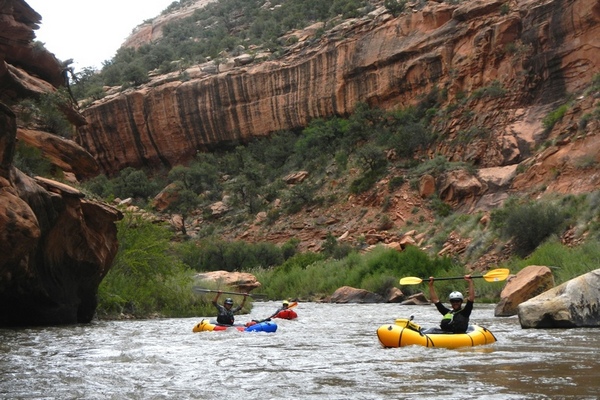
The West End of Montrose County has two rivers for water sports. The San Miguel River starts on the northern slopes of the San Juan Mountains and flows north easterly until it meets the Dolores River in the heart of the West End. The Dolores headwaters are just miles from the headwaters of the San Miguel, only on the southern slopes of the San Juan Mountains. Flowing south the Dolores toward the McPhee Reservoir, once in the Dolores River Canyon, the river moves in a north western direction into Dry Creek Basin, then continuing into the West End at the Paradox Valley. The Dolores River flows through the sandstone canyons of the West End, crossing into Utah, to the confluence with the Colorado.

[wpgmza id=”90″]
San Miguel River |
Dolores River |
|---|---|
| Pinon Bridge to Naturita: Season: Spring- Summer Day Use Pass: na Class of Rapids: I (IV- Varies with level) Length: na Put-in: Pinon Bridge American Whitewater.org |
Slickrock to Bedrock: Season: Spring-Summer Day-Use Pass: na Class of Rapids: II-III Length: 50 miles Put-in: Slickrock Bridge American Whitewater.org |
| Naturita to Dolores Confluence: Season: Spring- Summer Day Use Pass: na Class of Rapids: Length: miles Put-in: Naturita American Whitewater.org |
Bedrock to Gateway (Paradox and Mesa Canyon): Season: Spring-Summer Day-Use Pass: na Class of Rapids: II-III Length: 50 miles Put-in: Bedrock Launch Site American Whitewater.org |
| Gateway to Colorado River: Season: Spring-Summer Day-Use Pass: na Class of Rapids: II & IV Length: 30 miles Put-in: Gateway American Whitewater.org |
|