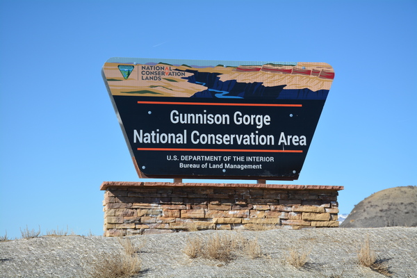
Located just to the north of Montrose and northeast of Delta, this National Conservation Area boasts 62,844 acres. Contained within the NCA is the Gunnison Gorge Wilderness Area, which preserves 17,784 acres of Colorado River corridor. Both the NCA and Wilderness Area border the Black Canyon of the Gunnison National Park. The primary activities of the National Conservation Area include hiking, biking, horseback riding, and ATV driving on primitive roads and trails. For instance, the Sidewinder Trail has a good 20 miles of single track, and there are three areas designed for ATV use, including the Flat Top Recreation Recreation and Staging Area, the Peach Valley Recreation and Staging Area, and the Elephant Skin Staging Area.
Fishing the Gold Medal Waters of the Gunnison River can be accomplished through trails taking one directly down to the Gorge and into the Wilderness Area. The wilderness area preserves 17,784 acres, with the primary activities of hiking, backpacking, fishing and floating on the Gunnison River. There are four major trails emanating from these access roads:
Chukar Road: 7 miles, trailhead for the Chukar Trail, 1.1 miles.
Bobcat Road: 1.5 miles, trailhead for the Bobcat Trail, 1.5 miles.
Duncan Road: 2.5 miles, trailhead for the Duncan Trail, 1.5 miles.
Ute Road: 2.5 miles, trailhead for the Ute Trail, 4.5 miles.
From Pleasure Park: North Fork to Smith Fork Trail, 4 miles.
The Gunnison Gorge National Conservation Area & Wilderness Area Brochure
Flat Top- Peach Valley OHV Brochure
Rafting in the Gunnison Gorge Wilderness Area:
Chuckar Trail to North Fork:
Season: Spring-Summer
Day-Use Pass: na
Class of Rapids: III
Length: 13.5 miles
Put-in: Chuckar Trail (1 mile from drop-off to Put-in on the Gunnison River.
American Whitewater.org
Hiking into the Gunnison Gorge Wilderness Area:
Chukar Trail:
Great views, Gold Medal Water with 1.1 mile trail down to the river. Chukar is the most heavily used trail in the NCA, with an elevations from 5,376 to 5,958 feet. Like many roads in Western Colorado, the Chukar invites one, with the last several miles being a progressively rougher four wheel drive road. As with all roads in the NCA, travel in wet weather is not advised. At the Trailhead there is a vault toilet, picnic tables with shade, and a visitor check-in and fee box.
Bobcat Trail:
A rough trail from the edge of the ridge down to the river. The last half mile of the Bobcat Trail is scrambling down cliffs to the river. This challenging route has an elevation difference from 5,529 to 6,249 feet.
Duncan Trail:
Trailhead is at the end of Duncan Road, with an elevation difference from 5,350 to 6,128 feet. The trail starts at a saddle on a ridge, with the view of the Uncompahgre Valley to the south and the Gorge to the north. From the trailhead, the distance to the river is 1.5 miles.
Ute Trail:
Ute Road is also listed as a four wheel drive route to the Trailhead. The Bobcat Trail is long and winding from the ridge into the gorge, with an elevation change from 5,369 to 6,512 feet. The distance from the ridge down to the river is 4.5 miles, with a trail along the river of over 3 miles in length. There are 4 designated hiker campsites. At the trailhead there is a vault toilet, shaded picnic table and grill, with a fee station with hiker registration.
North Fork to Smith Fork Trail:
 From Highway 92, between Austin and Hotchkiss, locate the Gunnison Gorge NCA sign, turn east on 28.10 Road to Pleasure Park. To access the North Fork to Smith Fork trail one must cross the North Fork of the Gunnison River and follow the trail east along the River for 4 miles of fishing access. At the trailhead there are vault toilets, picnic tables with shade, and cooking grills.
Check out our, “Ride The Gunnison Gorge NCA” page
Fishing the Gold Medal Water:
Gunnison River- elevation 5,058 feet
Fish: Brown Trout, Rainbow Trout
Access: Medium
Boating: Non-Motorized
Additional Info: From 5 miles above Austin (Relief Ditch Diversion) downstream to the confluence with the Colorado River in Grand Junction.
-No bag or possession limit for Channel Catfish, Largemouth Bass, Smallmouth Bass, Northern Pike, Walleye, Green Sunfish, Bluegill, Bullhead, Yellow Perch, or Crappie.
Flat Top- Peach Valley Recreation Area:
The Bureau of Land Management has designed special areas for OTV travel with out trail travel restrictions. At 9,700 acres, these recreation zones provide “play areas” for ATV, cross country motorcycles, and mountain bikes. Consisting of adobe hills and arroyos, as well as, juniper- pinon uplands, these “play areas” allow for un-restricted travel beyond a trail system.