This post is also available in:  English
 Français
 Deutsch
 日本語
日本語
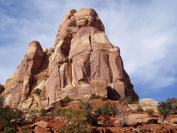
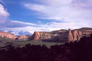
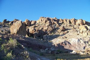
Grand Junction in Mesa County is the largest city on Colorado's Western Slope. Located in the midpoint of the Grand Valley, this service center boasts access to 2,693 climbing routes within a 40 mile radius. Mild winter temperatures support climbing activity in the spring and fall seasons. The chief advantage of the Grand Junction area is the massive number and variety of climbs that lie within a close proximity, giving climbers endless options for activity.
ARC'TERYX Presents Weekends with Piz - Weekend Warriors from ARC'TERYX on Vimeo.
[wpgmza id="97"]
Bangs Canyon: 13 Routes
 Located just before the East Entrance of Colorado National Monument: Broadway to Rim Rock Drive, 1 block to left on D Road, becoming Rosevale and Little Park Roads, 5 miles to the crest of the hill, turnoff to Rough and Bangs Canyons at the first left.
MountainProject.com: Bangs Canyon
Bookcliffs: 3 Routes
 Mountains located just to the north of the City of Grand Junction.
MountainProject.com: Bookcliffs
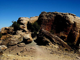
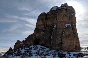
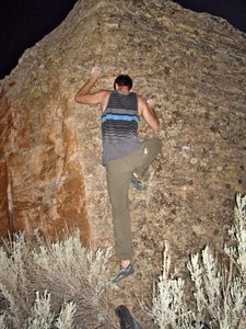
Bullet Hole Boulder Area: 38 Routes
 Located just off of Monument Road, .25 miles past the Tabeguache Trail Head, parking is on the right.
MountainProject.com: Bullet Hole Boulder Area
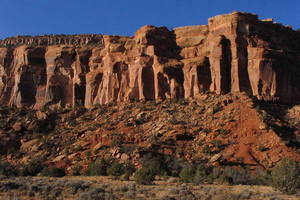
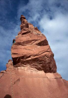
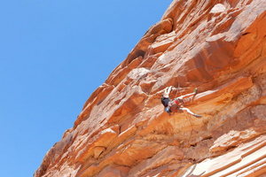
Colorado National Monument: 181 Routes
 Colorado National Monument is located just south of the City of Grand Junction.
MountainProject.com: Colorado National Monument
Colorado NM Climbing Page Link
De Beque Canyon: 38 Routes
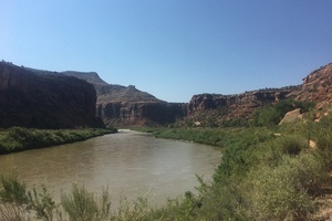
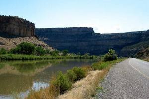 The Colorado River flows through De Beque Canyon in eastern Mesa County, I 70 access.
MountainProject.com: De Beque Canyon
Dominguez Canyon: 2 Routes
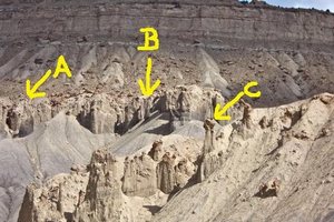
 Located south-east of Grand Junction, includes the Dominguez-Escalante National Conservation Area (210,172 acres). The Dominguez Canyon Wilderness Area (66,280 acres included in the NCA) is managed by the BLM, and is their largest roadless area in Colorado. The Wilderness Area sits in the middle of the NCA, showcases Big and Little Dominguez Canyons. This area consists of red rock canyons with sandstone bluffs, all part of the Uncompahgre Plateau.
MountainProject.com: Dominguez Canyon
Dominguez-Escalante NCA Map Pdf
Dynamite Shacks: 65 Routes
 Located just across from the Tabeguache Trail Head on Monument Road, parking on the right.
MountainProject.com: Dynamite Shacks
Escalante Canyon: 81 Routes
 Escalante Canyon lies in the south eastern part of the Dominguez-Escalante National Conservation Area. Not included in the Dominguez Canyon WA, this section of the NCA allows for vehicle access on established roads.
MountainProject.com: Escalante Canyon
Dominguez-Escalante NCA Map Pdf
Grand Mesa (Lands End): 82 Routes
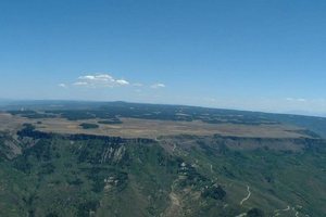 Take Highway 50 east of Grand Junction, 13 miles, travel east on Kannah Creek Road, follow signs to Lands End.
MountainProject.com: Grand Mesa (Lands End)
Holy Cross Boulders: 18 Routes
 From Grand Junction, Broadway to Rim Rock Drive, 1 block to left on D Road, becoming Rosevale and Little Park Roads, parking is at the Lunch Loop TH, just past the last house located on the right side of Little Park Road.
MountainProject.com: Holy Cross Boulders
McInnis Canyon Bouldering: 4 Routes
 Trail Head is just off of Hwy 340 (I70, Fruita exit), take Kings View Road (west) to Devil's Canyon Road, parking on the right.
MountainProject.com: McInnis Canyon Bouldering
McInnis Canyons: 8 Routes
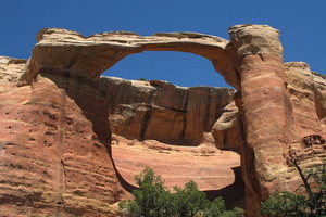 The McInnis Canyons National Conservation Area is located just north-west from the Colorado National Monument, and consists of 123,430 acres of BLM administered land. This NCA contains the Black Ridge Canyons Wilderness Area, which has 75,000 acres and the largest concentration of natural arches in North America
MountainProject.com: McInnis Canyons
Palisade: 19 Routes
 Climbing on Mt. Garfield area, access is by the Mt. Garfield Trail Head just north of the town of Palisade. The attraction is climbing the towers of talus located along the interstate.
MountainProject.com: Palisade Climbing
Rabbit Valley: 2 Routes
 Located west of Grand Junction, Rabbit Valley sits on the Colorado-Utah state line. The Rabbit Valley Staging Area is south of the interstate, use Exit 1.
MountainProject.com: Rabbit Valley
Rattlesnake Canyon: 1 Route
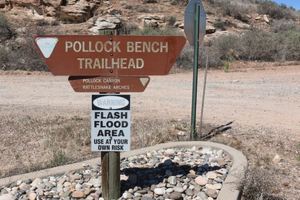 Rattle Snake Canyon is part of the McInnis NCA, located north-west of the Colorado National Monument. Rattle Snake Canyon is located in the Black Ridge Canyons Wilderness Area. Hiking in from the Pollock Bench TH makes a round trip length of 15.5 miles. A second trail head south of the canyon is the shortest route to the Canyon, however it requires a high clearance four wheel drive vehicle for the last several miles. See McInnis Canyons above.
MountainProject.com: Rattlesnake Canyon
Riggs' Hill: 73 Routes
 Named for Elmer S. Riggs, a paleontologist with the Field Museum of Natural History, the hill area is thought of as the first dinosaur quarry in Western Colorado. This area is littered with large boulders, for bouldering.
Mountainproject.com: Riggs' Hill
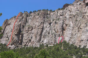
Rough Canyon: 13 Routes
 Located east of the Colorado National Monument, off of Little Park Road; at the Tabeguache Trailhead.
Mountainproject.com: Rough Canyon
South Camp: 17 Routes
 South Camp Bouldering Area is located off of South Broadway on South Camp Road on the Redlands. The desert hills in this area also the location for the Bullet Hole Boulders and the Dynamite Shacks area.
Mountainoroject.com: South Camp Bouldering
The Swimming Hole: 4 Routes
 Trail Head parking is at the Rustlers Loop TH, near Loma. Hike along the trail towards the Colorado River. The anchors for rappelling are located at the top of the cliff over the River.
Mountainproject.com: the Swimming Hole Rock Climbing
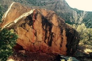
Tabeguache Boulders: 12 Routes
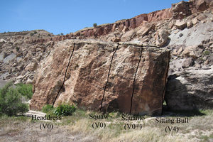 This boulder area is near the eastern boundary of the Colorado National Monument. Cross the Colorado River on Broadway, to Monument Road, follow south for 1.7 miles until reaching the Tabeguache/Lunch Loop TH (the same parking area for Dynamite Shacks), boulder area is located off the Tabeguache Trail.
Mountainproject.com: Tabeguache Boulders
Unaweep Canyon: 2019 Routes
 Unaweep Canyon is located just east of Grand Junction, take Highway 50, turning south on Highway 141 south.