Moab is near the confluence of the Green and Colorado Rivers in east-central Utah. The Green is a chief tributary of the Colorado, being born in the Wind River Mountains of Wyoming, mainly flows through Wyoming and Utah, with a 40 detour into northwestern Colorado.
John Wesley Powell boated the Green and Colorado Rivers in 1869. The area of the lower Great Basin where the Green and Colorado Rivers flow, was one of the last great unknown regions in the West. Powell put-in at Green River, Wyoming, the ran both the Green and the Colorado Rivers down well into southwestern Utah. Today there is access to the lower Green starting below the Flaming Gorge Reservoir, and flowing into the Colorado at the confluence in Canyonlands National Park.
Our brief guide includes the Colorado River from the Loma launch to Moab, and from Moab to the pull out on Lake Powell.

[wpgmza id=”51″]
Green River SectionGreen River (Utah) Flaming Gorge to Lodore (Colorado): |
Green River, Lodore to Echo Park: Season: Spring- Summer Day Use Pass: National Parks Class of Rapids: II-IV Length: 19 miles Put-in: Lodore Ranger Station American Whitewater.org |
| Green River (Colorado) at Echo Park to Split Mountain (Split Mountain Canyon): Season: Spring- Summer Day Use Pass: National Parks Class of Rapids: II-IV Length: 26 miles Put-in: Echo Park Campground American Whitewater.org |
Green River (Utah), Ouray to Green River (town): Season: Spring- Summer Day Use Pass: na Class of Rapids: II-III Length: 128 miles Put-in: American Whitewater.org |
| Green River (Town) to Colorado Confluence: Season: Spring- Summer Day Use Pass: Permit Required Overnight Class of Rapids: I Length: 120 miles Put-in: Green River State Park American Whitewater.org |
|
Green River At Green River, Ut
|
Green River At Mineral Bottom Nr Cynlnds Ntl Park
|
Ruby Horsetheif Canyon Permits:
This first 25 mile section of the river from the Loma Launch to Westwater Launch has available BLM Campsites along the river. Due to the limited availability of camping, permits from the BLM are required and must be reserved in advance. Due to the remoteness of this section of the river there are no take-outs and limited cell phone service.
Recreation.gov
Colorado River SectionColorado River, Loma launch to Westwater launch (Ruby to Horsetheif): |
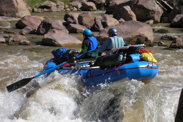
Westwater launch to Rose Ranch (Westwater Canyon): Season: Spring- Summer Day Use Pass: na Class of Rapids: I-IV Length: 17 miles Put-in: Westwater American Whitewater.org |
| Cisco (Rose Ranch) to Moab: Season: Spring- Summer Day Use Pass: na Class of Rapids: I-III Length: 47 miles Put-in: Rose Ranch American Whitewater.org |
Confluence with Green River to Lake Powell: Season: Spring- Summer Day Use Pass: na Class of Rapids: I-IV Length: 112 miles Put-in: Confluence of the GreenAmerican Whitewater.org |
| Bureau of Land Management Grand Junction Field Office 2815 H Road Grand Junction, CO 81506 River Permit Phone: (970) 244-3000 |
|