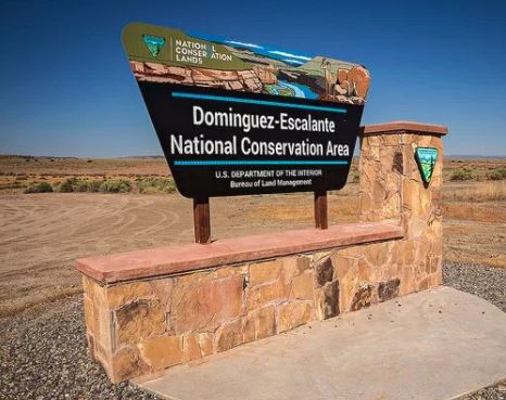
Located just to the south of Highway 50, between Delta and Grand Junction, the Dominguez-Escalante National Conservation Area consists of 210,172 acres of south to north red sandstone canyons which drop into the Colorado River. Within the NCA is the Dominguez Canyon Wilderness Area with 66,280 acres. This Wilderness Area provides additional protections for threatened animal and plant species by controlling access through horseback or foot traffic. In total this red sandstone canyon country preserves cultural historic sites dating back 10,000 years. The Canyons of Escalante, Little Dominguez, Big Dominguez, and Cottonwood drain the eastern section of the Uncompahgre Plateau into this 30 mile section of the Colorado River.
Basecamp Delta County Link
Recreation Areas:
Cactus Park:
Activities: mountain biking, OHV riding on existing roads and trails, horseback riding, wildlife viewing and hiking. Access is by State Highway 141, the Cactus Park Road, and the Divide Road from the Uncompahgre Plateau. The 142 mile Tabeguache Mountain Bike Trail goes through Cactus Park. Cactus Park provides miles of trails and roads for motorized vehicles or mountain bikes. The Gunnison Gravels Area of Critical Environmental Concern preserves a gravel deposit whose physical characteristics provide evidence that the ancestral Gunnison River once flowed through Cactus Park and the Unaweep Canyon area.
Tabeguache Trail- Cactus Park Section:
Dominguez Canyon Wilderness Area:
Activities: (non-motorized travel) horseback riding, wildlife viewing and hiking. The main Big Dominguez Trail provides access to the scenic canyons and mesas in the wilderness area. The Dominguez Canyon WA includes streams, waterfalls, Native American rock art, historic structures from the heydays of mining, geologic features and wildlife. The easiest access point is at the Bridgeport Trailhead south of Highway 50. Turn on to the graveled Bridgeport Road for 3 miles down to the trailhead. There is a lower parking area which is mostly used for paddle access to the Gunnison River. There is a foot bridge for crossing the river with information kiosk before entering the gated wilderness area. Access to Little Dominguez Canyon is around 2.5 miles after entering through the gate. The upper end of Big Dominguez Canyon can be accessed from the Big Dominguez Campground, which is 11 miles off of Highway 141. The road to the Campground is gravel and not advisable for RVs or trailers. Camping by the river is limited to boaters with portable toilets. Backcountry camping is not permitted in the lower 5 miles of Big Dominguez Canyon and the lower 3 miles of Little Dominguez Canyon. There is a backpacking option for hiking both Big and Little Dominguez Canyons.
Hike Big Dominguez Canyon:
Escalante Canyon:
Activities: camping, hiking, access to Dominguez Canyon Wilderness Area, ATV driving on existing roads and trails, and picnicking. Escalante Canyon includes the Potholes Recreation Area, located 12 miles up the canyon on the gravel road. The recreation site has picnic tables, shade shelters and designated campsites. Be aware, swimming in the Potholes is dangerous, as there is a rotating water current that cannot be seen from the surface that is dangerous to swimmers. The Escalante Canyon Road provides vehicle access to historic cabins and trails in the rock walled canyon. There is Native American rock art, as well as historic inscriptions on canyon walls.
Dominguez- Escalante National Conservation Area Map
Dominguez- Escalante National Conservation Brochure


