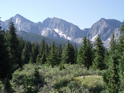
Including most of the Sawatch Range, the Collegate Peaks Wilderness Area is bounded by the Leadville- Buena Vista on the east, and Aspen- Crested Butte on the west. The Area includes five peaks over 14,000 feet. This Wilderness Area serves as an important watershed that straddles the continental divide, including the Arkansas, Gunnison, and Roaring Fork Rivers.
USGS Topo Maps Link:
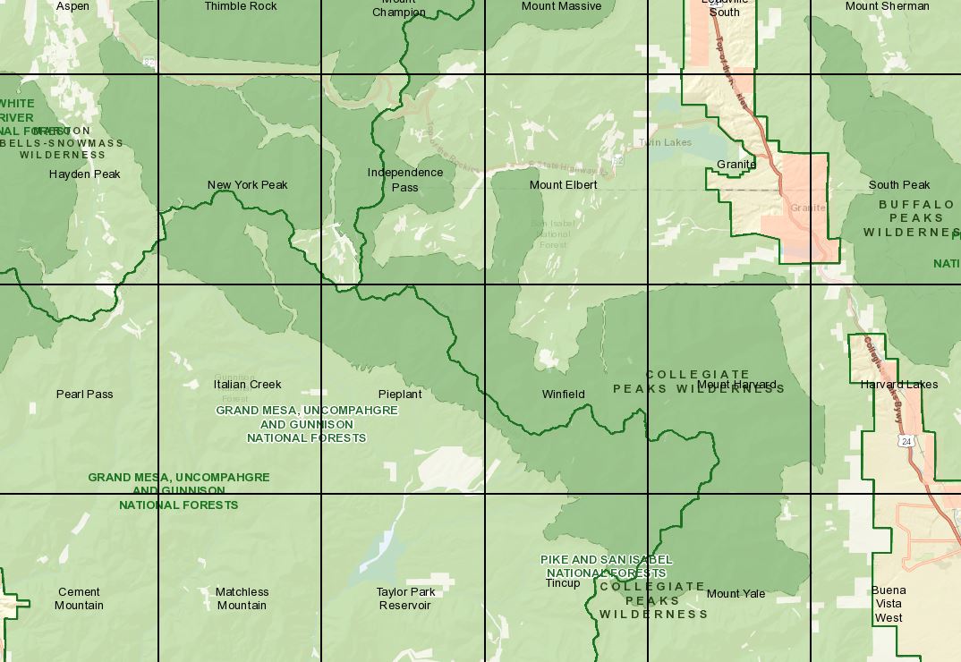
| Tincup | Mount Yale | Winfield |
| Mount Harvard | Pieplant | Italian Creek |
| Hayden Peak | New York Peak | Independence Pass |
| Mount Elbert | Aspen |
Established: 1978
Acres: 132,906
Elevation Range: 7,850 to 13,534 feet
Peaks:
La Plata Peak- 14,340 feet
Missouri Mountain- 14,067 feet
Mount Harvard- 14,420 feet
Mount Belford- 14,197 feet
Huron Peak- 14,005 feet
Mount Princeton- 14,196 feet
Mount Oxford- 14,153 feet
Mount Yale- 14,196 feet
Mount Columbia- 14,073
Towns: Leadville, Buena Vista, Aspen, Crested Butte, Salida
Hunting Areas: 471, 48, 481, 55
Trail Heads:
Trailhead at the end of Taylor Park Road (CR 742)
Bowman Creek Trail #570
Dorchester Campground/ Forest Road #584
New York Creek Trail #2182 (White River NF)
Ptarmigan Lake trail #594
Trailhead at Pothole Reservoir:
Timberline Trail #414
Red Mountain Creek Trail # 543 (area is unavailable)
Texas Creek Trailhead:
Timberline Trail # 414,
Lake Ann Trail #592
Texas Creek Trail #416
Cottonwood Pass:
South Texas Creek # 417
Collegiate Peaks Trailhead (San Isabel NF)
North Denny Creek #1442
Links: