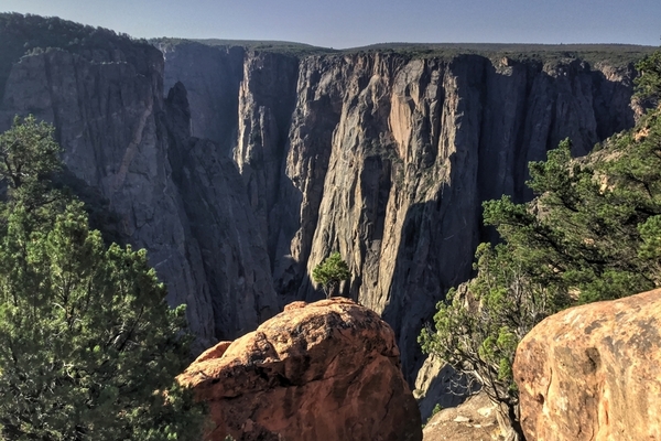
South Rim Hiking: Both the South Rim and North Rim offer two types of hiking trails, inner canyon (which require planning and permitting) and rim top trails. The inner canyon permit is used by those hikers who travel on or off established trails, all river use, and rock climbers. Permits are free, and can be picked up at the Visitor Center on the South Rim, the North Rim Ranger Station, or the registration board at the East Portal. Each day has a limited number of permits which are distributed on the first-come, first-served basis. Safety and back country use monitoring are the primary reasons for this permit system.
Hiking the Inner Canyon NPS Link
USGS Topographic Maps Links:
South Rim Visitor Center
9800 Highway 347
Montrose, CO 81401
970-641-2337 x205
Permits are not required for hiking established hiking trails which inclued:
-Rim Rock Nature Trail
-Oak Flat Loop Trail
-Cedar Point Nature Trail
-Warner Point Nature Trail
-Uplands Trail
-Chasm View Nature Trail
-North Vista Trail
-Deadhorse Trail
-Green Mountain Trails
Anyone fishing the river at the East Portal including boaters, hikers and overnight backpackers require a permit.
South Rim Trails Requiring Permit:
Warner Route:
Gunnison Route:
Tomichi Route:
North River Route: (North Rim hike accessable from the South Rim)
Non-permitted Trails:
Rimrock to Uplands Loop:
Oak Flat Trail:
Cedar Point Trail:
Warner Point Nature Trail:
Red Rock Canyon Route:
Dragon Point Trail:
Painted Wall View Trail:
Devils Lookout Trail:
Rock Point Trail: