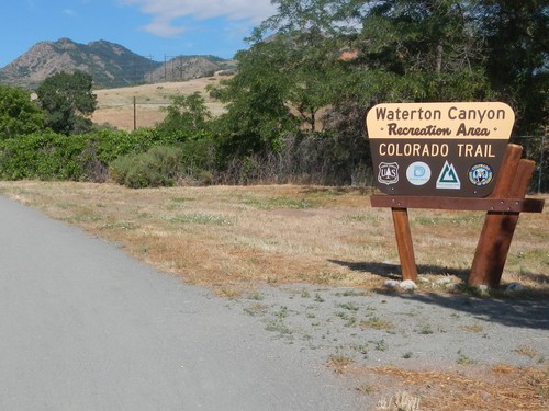
The Waterton Canyon Trail Head is the end or beginning point of the Colorado Trail. The Canyon is administered by the Denver Water Board, as the South Platte River flows through Waterton Canyon. Directions: from Wadsworth Boulevard (Hwy 121) south of C-470 past Chatfield Reservoir, turn on to Waterton Road, travel to the second entrance with a parking lot on the left. The Canyon has 6.5 miles of trail to the Strontia Springs Dam, with the Trail above the lake. approximately 10 miles to the confluence of the North Fork of the South Platte and the South Platte River.
Waterton Canyon Recreation Map
Denver Water Information Link : Waterton Canyon
Waterton Canyon: Colorado Trail.org
If your plans include leaving a vehicle in Waterton Canyon, consult both the Trail.org and Denver Water websites for additional information.
Section 1: Waterton Canyon TH to South Platt River TH
Distance: 16.8 Miles
Elevation Gain: 2,830 feet
Ranger District:
South Platte RD, Pike NF
19316 Goddard Ranch Court
Morrison
(303) 275-5610
Section 2: South Platte TH to Little Scraggy TH
Distance: 11.5 miles
Elevation Gain: 2,482 feet
Ranger District:
South Platte RD
19316 Goddard Ranch Court
Morrison
(303) 275-5610
Section 3: Little Scraggy TH to FS-560 (Wellington Lake) TH
Distance: 12.2 miles
Elevation Gain: 1,975 feet
Ranger District:
South Platte RD
19316 Goddard Ranch Court
Morrison
(303) 275-5610
Section 4: FS-560 (Wellington Lake) TH to Long Gulch
Distance: 16.6 miles
Elevation Gain: 3,271 feet
Ranger District:
South Platte RD
19316 Goddard Ranch Court
Morrison
(303) 275-5610
South Park RD
320 Hwy 285
Fairplay
(719) 836-2031
Section 5: Long Gulch to Kenosha Pass
Distance: 14.6 miles
Elevation Gain: 1,858 feet
Ranger District:
South Platte RD
19316 Goddard Ranch Court
Morrison
(303) 275-5610
South Park RD
320 Hwy 285
Fairplay
(719) 836-2031
Section 6: Kenosha Pass to Goldhill TH
Distance: 32.9 miles
Elevation Gain: 5,196 feet
Ranger District:
Dillon RD, White NF
680 Blue River Parkway
Silverthorn
(970) 468-5434
Section 7: Goldhill TH to Copper Mountain
Distance: 12.8 miles
Elevation Gain: 3,674
Ranger District:
Dillon RD, White River NF
680 Blue River Parkway
Silverthorn
(970) 468-5434