This post is also available in:  English
 Français
 Deutsch
 日本語
日本語
Cortez Basecamp Sponsors


Located between Durango and Cortez in Southwestern Colorado, Mesa Verde (Green Table) preserves over 4,300 archaeological sites, which includes 600 cliff dwellings. Mesa Verde was occupied by the Ancestral Puebloan people from CE 600 to 1300. The first protection of area ruins started in 1889 with the Goodman Point Pueblo (Hovenweep NM). Mesa Verde attracted the attention of artifact collectors, with "curio seekers" vandalizing ruins in their search for salable artifacts. Established by President Theodore Roosevelt, with the goal of preserving "the works of man," on June 29, 1906. Roosevelt also signed the Federal Antiquities Act in 1906 to further protect cultural treasures. The creation of Mesa Verde National Park was a first to protect an area of cultural significance.
It is estimated that seasonal settlement started around 7,500 BCE, with nomatic Paleo-Indians (the first people), with the Basketmaker Culture developing at 1,000 BCE. The Ancestral Puebloans developed from the Basketmaker Culture around 750 CE. Settlement trends started with nomatic, semi-nomatic, with permanent communities commencing in the first century CE. At Mesa Verde, the first structural villages were pueblos which date from the mid seventh century. Starting at the end of the 12th Century the cliff dwellings emerged. It is felt that prolonged drought and the resulting social instability, caused the movement of Ancestral Pueblans from Mesa Verde.
![]()
Spanish influence began in the Valley of the Rio Grande in the 16th and 17th Centuries. The Spanish government exploration commenced with the Don Juan de Oñate in 1598. The settlement of Santa Fe area occurred in 1607. The Spanish government officially established Santa Fe as the provincial capitol in 1610.
By the end of the 18th Century, exploration began north and northwest of Santa Fe. The first expedition into the area of Northern New Mexico and Southern Colorado was by Juan Rivera in 1765. The search for wealth was a consistent motivator for Spanish exploration. This search drove Coronado into the midwest on a 4,000 mile (6,400 KM) in 1541. The governor of New Mexico was acting on the same theme when he ordered Rivera into the land of the Utes. Rivera believed that there were silver mines in the area of southern Colorado and there was a bearded tribe of natives who were of light complexion, living in the land of Teguayo.
Santa Fe was interested in the exploration of Teguayo, to discover if the bearded light skinned people were Europeans living northwest of New Spain. Rivera's first travels (June-July) took him to the La Plata Mountains where he returned with a wealth of ethnographic data on local peoples and some silver nails (clavos de plata). It is noteworthy the Rivera discovered ruins, and made the first archaeological investigation made in the continental United States. (Baker, 2015) Rivera helped to pacify the native Ute population, furthering the goal of improving diplomatic and trade relations. Rivera made his second trip from September through the first week of November. His small band was able to retrace their first trail, then continuing west to the Big Bend of the Dolores River, crossing the Dolores and continuing northward over a series of trails that would become known as the Navajo-Uncompahgre Trail, ending up at the Gunnison River Bottoms south of the present city of Delta.
Rivera's journals provided the first account of the land and it's inhabitants in western Colorado. Members of River's expedition were able to assist the Dominguez- Escalante expedition in 1776. The Friars traveled north west along Rivera's route, to the Big Bend, and north along the Navajo-Uncompahgre Trail, over the Uncompahgre Plateau to the Delta bottoms. They were able to cross the Gunnison at Delta, eventually crossing the Colorado River further north. One of their goals was the discovery of an overland route to Alta California. Dominguez and Escalante were able to travel into central Utah, and see the "bearded" natives, before heading south and crossing the Colorado River on their return to Santa Fe. Dominguez and Escalante are credited with the naming of Mesa Verde, even though they didn't explore the top of the mesa.
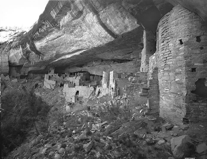
WH Jackson, Cliff Palace
By the mid 19th century, Mexico had won it's independence from Spain, and lost the colony of New Mexico to the United States in the 1848 Treaty of Gudalupe Hidalgo. Through this treaty Mexico ceded New Mexico and Alta California including the vast desert area of the Great Basin. The American nation now stretched from the Atlantic to the Pacific Ocean. Anglo American settlement and government surveys put pressure on the native inhabitants leading to the establishment of the reservations of Uintah and Ouray in 1861. The miners and the settlers who followed opened up western Colorado during the last twenty years of the 19th Century. John Moss, a prospector had explored the Mesa, leading the photographer William Henry Jackson into Mancos Canyon to view and photograph Mesa Verde's ruins in 1873. Jackson contributed to the Hayden Survey (1876) of the area of Western Colorado. With the Ute Treaty (1873), the land of Mesa Verde become part of the Ute Reservation.
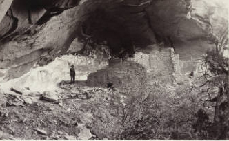
Richard Wetherill among the cliff dwellings
(credit: Denver Public Library)
It was Richard Wetherill (1858- 1910) a Mancos area rancher who was able to graze his cattle at the top of Mesa Verde. On December 18, 1888, Wetherill and Charlie Mason spotted the Cliff Palace ruin from a canyon rim. The Wetherill family was instrumental in bringing outsiders into the region to explore the ruins. In 1889 and 1890, they hosted Frederick H. Chapin, and later in 1891 Adolf Erik Nordenskiöld. Their activity, and subsequent collection of artifacts from the area resulted in the eventual creation of the National Park by Roosevelt in 1906.
Digging Deeper: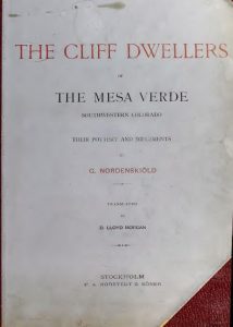 The Cliffdwellers of the Mesa Verde. Adolf Erik Nordenskiöld, Stockholm, 1893.
Area: 52,485 Acres
Driving: Located on US 160, 9 miles east of Cortez and 7 miles west of Mancos.Park Map Pdf
Headquarters Map Pdf
Wetherill Mesa Map Pdf
Farview Sites Map Jpg
Major Cliff Dwellings
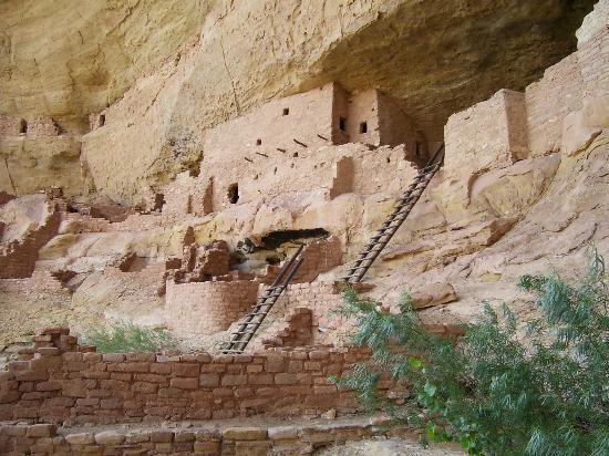
Balcony House:
Balcony House, National Park Service
Balcony House is considered a medium sized cliff dwelling, containing 40 rooms. Due to it's location, to visit this ruin, a ranger guided tour is necessary. Entrance is through a canyon descent of a hundred foot stair case, climbing a 32 foot ladder, and crawling through a tunnel. At 7,000 feet in elevation, a visit into the Balcony House requires physical exertion. Not recommended for any one with heart or respiratory problems.
![]()
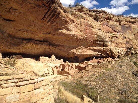
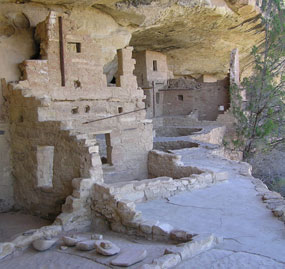
Cliff Palace:
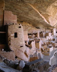
Cliff Palace, National Park Service
Long House:
 Located on Wetherill Mesa, the Long House is considered the second largest cliff dwelling in the park. The Long House Village was built in a 298 foot long alcove within the cliff. There were about 150 rooms and 21 kivas. The beams found in the Long House date from CE 1145- 1279. Archaeologists have estimated that the ruin was inhabitated by 150 to 175 people.
This cliff dwelling also requires a ranger guided tour that begins at the Wetherill Mesa Kiosk.
![]()
Mug, Oak Tree, Spruce Tree, and Square Tower Houses:
Mug House is located on Wetherill Mesa with 94 rooms, a large kiva and reservoir. Named for mugs found on site.
Oak Tree House is visited by a guided ranger tour.
Spruce Tree House is the third largest village, with 130 rooms and 8 kivas. Construction between 1211 and 1278. It is estimated that between 60 to 80 people lived in Spruce Tree House. Self Guided Tour
Step House is an unusual ruin, in that archaeologists have discovered two separate human habitations exist in the same dwelling. The first occupation occured during the Modified Basketmaker period, 626 CE, with the second demonstrating Classic Pueblo masonry, dating from 1226 CE.
Square Tower can be seen on the Mesa Top Loop Road driving tour, and is the tallest structure in the Park.
![]()
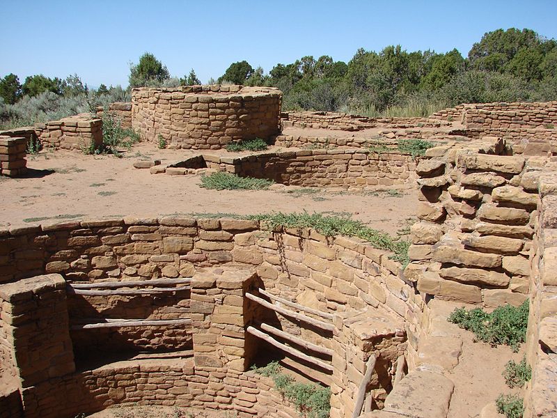
Mesa Top Sights
Mesa Top Sites:
Badger House Community:
 The Badger House Community consists of four sites: the Modified Basketmaker Pithouse, Developmental Pueblo Village, the Badger House, and the Two Raven House. Start at the Wetherill Mesa Kiosk. These Badger House ruins are an example of a Late Pueblo III mesa-top ruin. Within this community is a kiva with a 41 foot tunnel that connects to a tower.
![]()
Cedar Tree Tower:
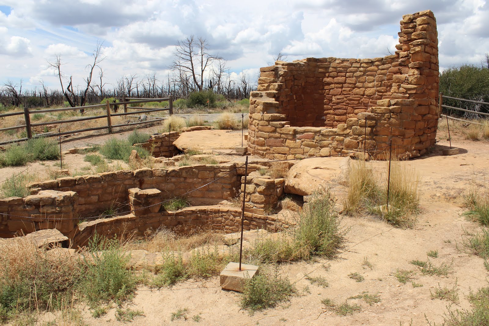 Within the Park, several tower sites have been discovered. Dating indicates they were built during the "Pueblo III Period" period (CE 1150-1300). "Some (towers) are situated in prominent locations with sweeping vistas, and others are tucked into canyon bottoms. Some are square, and others D-shaped. Many are attached to kivas, some are incorporated into room blocks, and several stand alone. Over the past century, archaeologists have interpreted the towers as defensive strongholds, lookouts, signaling stations, astronomical observatories, storehouses, and ceremonial facilities. These functions need not have been mutually exclusive, although explaiations that relate to the towers' visability are among the most convincing." (Van Dyke, King, 2010)
![]()
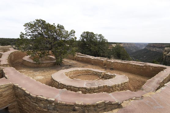
Far View sites:
In this area almost 50 villages have been identified within a half square mile area. These villages contained hundreds of people. Surface sites: Far View House, Pipe Shrine House, Coyote Village, Farview Reservoir, Megalithic House and the Far View Tower. The dwellers at Far View were living on top of the Mesa for at least several hundred years before the construction of the cliff dwellings.
![]()
Sun Temple:
 It is thought by the mondern Pueblo Indians, that the features of the Sun Temple are ceremonial in nature. At this site roof beams, as well as house hold goods are absent. Concrete has been placed on top of the walls for preservation. The walls were constructed with two courses and a rubble stone core.
![]()
Baker, Steven G. Juan Rivera's Colorado, 1765: The Frist Spaniards Among the Ute and Paiute Indians on the Trails to Teguayo, Lake City, 2015.
Van Dyke, Ruth M., King, Anthony G. (March 25, 2010) Connecting Worlds: Pueblo III Towers in the Northern San Juan. Retrieved from: http://bingweb.binghamton.edu/~rvandyke/public_html/Publications_files/03%20kiva%2075-3%20van%20dyke.pdf