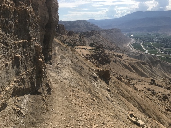
Mount Garfield with an elevation of 6,637 is the highest point in the Bookcliff Mountains. This range stretches almost 240 miles from just east of Palisade into eastern Utah. The cliffs are created with Cretaceous sandstone, with the top layer looking like books in a book shelf. An interesting feature of this range is the lack of eroded access canyons climbing to the top of the plateau. The Colorado River cuts through this landmass creating DeBeque Canyon, just east of Palisade.
Before 1921, the Colorado River was commonly known as the Grand River, from the confluence with today’s Gunnison River west to the confluence with the Green River in eastern Utah. The Gunnison River name was not widely used until the 1870’s, prior names included: South Fork of the Grand River, Bunkara River, Eagle Tail, Eagle River, Grande River, and Grand River. It took a Colorado Congressman in 1921 to petition Congress to make the name change from Grand River to the Upper Colorado River, or as we call it today, the Colorado River.
USGS Topo Maps Link:
| Palisade | Cameo | |
| Round Mountain | Clifton |
Mount Garfield Trail:
Stagecoach Trail:
North Stagecoach Trail:
Stagecoach Connector Trail:
Palisade Rim Trail:
Watch for Mountain Bikes!