White River, Wikipedia.org
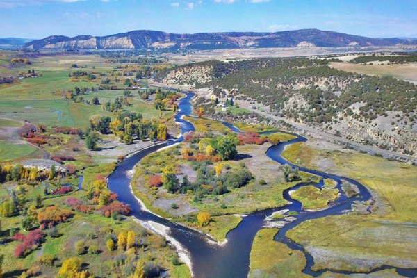
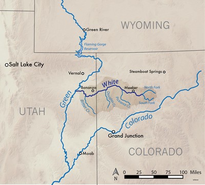
The White River in north central Colorado is a tributary of the Green River, which flows into the Colorado at Moab, Utah. Starting in the Flat Tops Wilderness Area in northeastern Garfield County, the White stretches for 195 miles. The North Fork of the White starts at Wall Lake and flows northwest, then southwest. The South Fork rises about 10 miles south of the North Fork, and meets near Buford, forming the White River proper.
[wpgmza id=”61″]
| North Fork, White River:
Season: Spring- Summer
Day Use Pass: na
Class of Rapids:
Length: 20 miles
Put-in: Mirror Lake
American Whitewater.org |
South Fork, White River:
Season: Spring- Summer
Day Use Pass: na
Class of Rapids: III-IV
Length: 10 miles
Put-in: Notional Forest CG
American Whitewater.org |
| South Fork, White River:
Season: Spring- Summer
Day Use Pass: na
Class of Rapids: III-IV
Length: 10 miles
Put-in: Notional Forest CG
American Whitewater.org |
|
- Temperature: 61.34 ° F
- Streamflow: 643 ft³/s
- Gage height: 2.59 ft
USGS
|
- Temperature: 39.2 ° F
- Streamflow: 693 ft³/s
- Gage height: 3.38 ft
USGS
|
- Temperature: 52.88 ° F
- Streamflow: 660 ft³/s
- Gage height: 3.22 ft
USGS
|
|