White River, Wikipedia.org
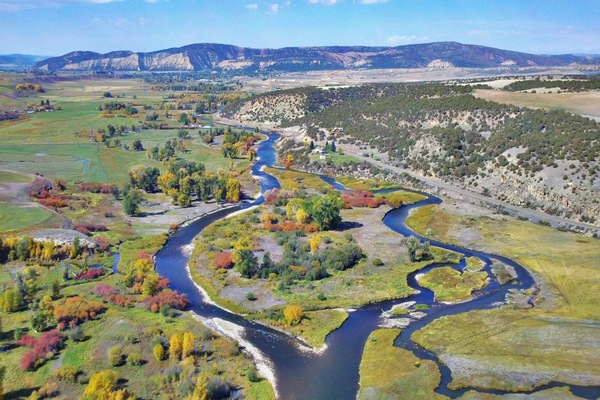
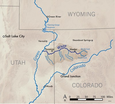
Die White River in North Central Colorado ist ein Nebenfluss des Green River, die fliesst in das Kolorado in Moab, Utah. Beginnend in der Deckelgarnituren Wildnis im Nordosten Garfield County, der Weiße erstreckt sich über 195 Meilen. Die North Fork des Weißen beginnt an der Wand See und fließt nordwestlich, dann Südwest. Der South Fork erhebt sich etwa 10 Meilen südlich des North Fork und trifft in der Nähe von Buford, die den White River.
[wpgmza id=”61″]
| North Fork, White River:
Season: Spring- Summer
Day Use Pass: na
Class of Rapids:
Length: 20 miles
Put-in: Mirror Lake
American Whitewater.org |
South Fork, White River:
Season: Spring- Summer
Day Use Pass: na
Class of Rapids: III-IV
Length: 10 miles
Put-in: Notional Forest CG
American Whitewater.org |
| South Fork, White River:
Season: Spring- Summer
Day Use Pass: na
Class of Rapids: III-IV
Length: 10 miles
Put-in: Notional Forest CG
American Whitewater.org |
|
- Temperature: 54.86 ° F
- Streamflow: 637 ft³/s
- Gage height: 2.58 ft
USGS
|
- Temperature: 39.2 ° F
- Streamflow: 724 ft³/s
- Gage height: 3.43 ft
USGS
|
- Temperature: 52.88 ° F
- Streamflow: 654 ft³/s
- Gage height: 3.21 ft
USGS
|
|
nt]