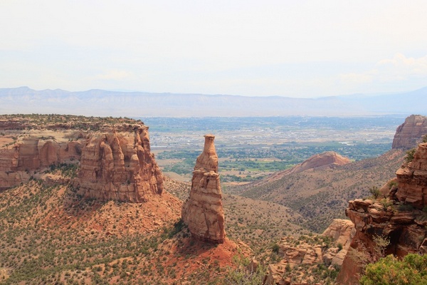
The Trail Head for the Monument Canyon is located just off of State Hwy 340, about 2.1 miles east of the West Park Entrance. The lower part of Monument Canyon offers excellent views of towering rock formations. Hikers should be …
Below you'll find a list of all posts that have been tagged as “hike”
The Trail Head for the Monument Canyon is located just off of State Hwy 340, about 2.1 miles east of the West Park Entrance. The lower part of Monument Canyon offers excellent views of towering rock formations. Hikers should be …
Named for the Grand (Colorado) River, the Grand Valley is about 30 miles long and 5 miles wide. With the Uncompahgre Plateau to the south and the Book Cliff Range to the north, the valley provides multiple venues for outdoor …
Located on the western edge of the Grand Valley, Furita is the perfect basecamp for riding the Kokopelli Trail and surfing the Colorado into Utah. Settlement began in the 1880’s with town founder William Pabor, with incorporation in 1844. In …
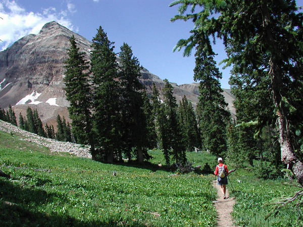
Section 22: Spring Creek TH to Carson Saddle Distance: 17.2 miles Elevation Gain: 3,829 feet Ranger District: Gunnison RD, GMUG NF 216 North Colorado Gunnison (970) 641-0471 Divide RD, Rio Grande NF 13308 West Hwy 160 Del Norte (719) 657-3321 …
Section 15: US 50 to Marshall Pass TH Distance: 14.3 miles Elevation Gain: 3,576 feet Ranger District: Salida RD, San Isabel NF 5575 Cleora Road Salida (719) 539-3591 Gunnison RD, GMUG NF 2250 Highway 50 Delta (970) 874-6660 Section 16: …
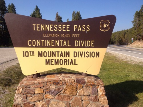
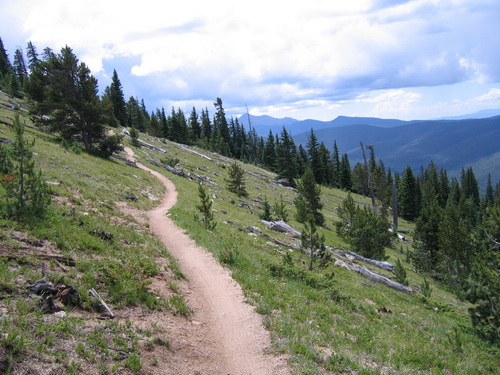
Section 8: Copper Mountain to Tennessee Pass TH Distance: 25.4 miles Elevation Gain: 4,417 feet Ranger District: Dillon RD, White River NF 680 Blue River Parkway Silverthorn (970) 468-5400 Holy Cross RD, White River NF 24747 Hwy 24 Minturn (970) …
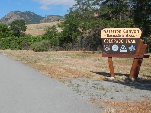
Der Waterton Canyon Trail Head ist das Ende oder der Anfang der Colorado Trail. Der Canyon ist durch die Denver Wasser Vorstand verwaltet, wie der South Platte River durch Waterton Canyon fließt. Wegbeschreibung: von Wadsworth Boulevard…
Denken an das Wandern der Colorado Trail? Colorado’s berühmten Long distance Trail, fast 500 km, verläuft von Denver nach Durango. Der Weg führt durch sechs Wildnis, Kreuzung 8 Bergketten, insgesamt einen Anstieg von 89,354 m. Im Jahr 2004, der Colorado …

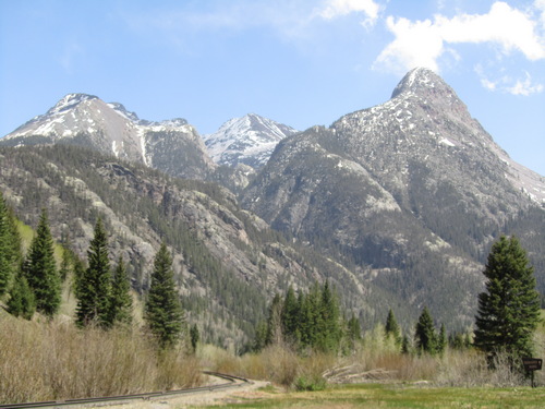
Diese Wege sind im Süden und Westen von Silverton in den San Juan Mountains. Silverton sitzt bei 9,318 Metern und ist eine Bergbaustadt aus dem Jahre 1880. 23 Meilen südlich von ouray auf der berühmten “Million Dollar Highway”, silverton entfernt …
Durango befindet sich im Herzen von San Juan National Forest umfasst 1,8 Millionen Hektar. Wildnisgebiete gelang es durch diesen Wald gehören Weminuche, Lizard Head South San Juan und Hermosa Creek. USGS Topo Maps Link: Durango West Durango East Monument Hill …